Roman Bridge Discovered Beneath Dutch River Reveals New Insights Into the Empire’s Northern Infrastructure
Massive oak foundations uncovered in the Meuse River suggest that Roman engineers built a major bridge in the Netherlands during the late fourth century, highlighting the importance of frontier transportation networks during a turbulent period of imperial history.
Deep beneath the bed of the Meuse River in the central Netherlands, archaeologists have uncovered evidence of a remarkable Roman engineering project that remained hidden for more than 1,600 years.
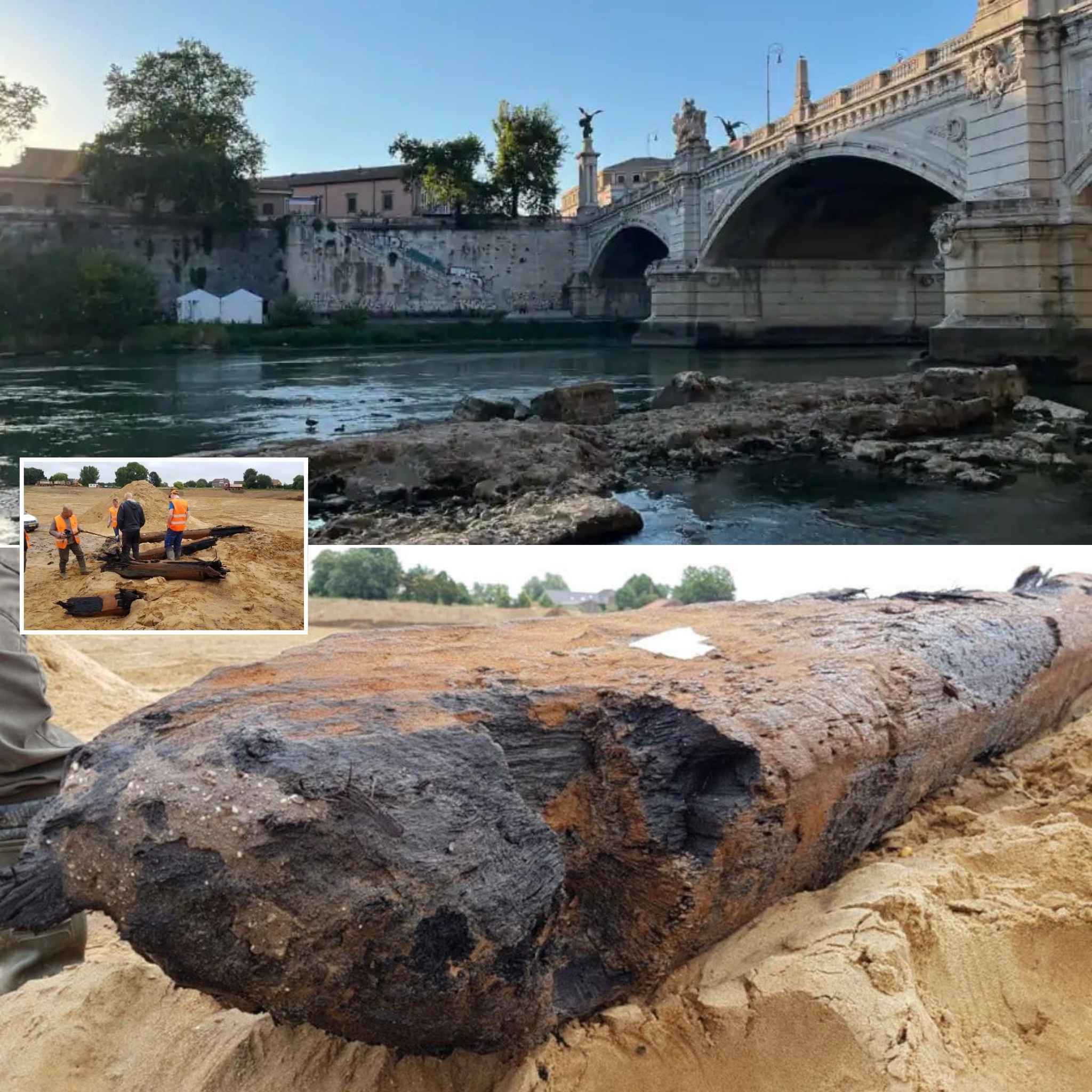
The discovery consists of several enormous oak piles driven into the ancient riverbed, the remains of what researchers now believe was a substantial Roman bridge built during the late fourth century A.D.
Although the Roman presence in the Netherlands has been studied for generations, the newly identified crossing reveals that the empire’s transportation network in the region was more extensive and strategically important than previously understood.
The bridge appears to have linked key routes across the river at a time when the Roman Empire faced increasing military pressure along its northern frontier.
More than simply a feat of engineering, the structure offers a glimpse into how Roman authorities adapted to environmental challenges, maintained military mobility, and invested in infrastructure even during one of the empire’s most unstable periods.
A Discovery in the Riverbed
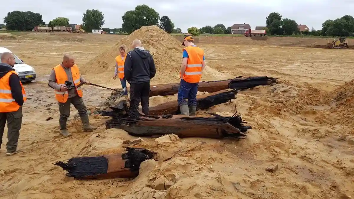
The remains were uncovered during the Over de Maas project, a large-scale sand extraction operation near the town of Dreumel in Gelderland Province.
Since work began in 2010, the project has become one of the most productive archaeological landscapes in the Netherlands.
Thousands of years of human activity have left traces within the river sediments.
Excavations have yielded an extraordinary range of discoveries, including:
- Mammoth teeth and molars
- Prehistoric tools
- Ancient ceramics
- Roman pottery
- Weapons
- Medieval artifacts
In total, approximately 400,000 archaeological objects have been recovered.
Yet among this enormous collection, four massive oak piles immediately stood out.
Unlike smaller artifacts that can be easily categorized, these timbers suggested the presence of a substantial structure hidden beneath the river.
Their size alone hinted at an ambitious construction project.
Researchers quickly realized they were dealing with something exceptional.
Giant Oak Foundations
The preserved timbers are remarkable in scale.
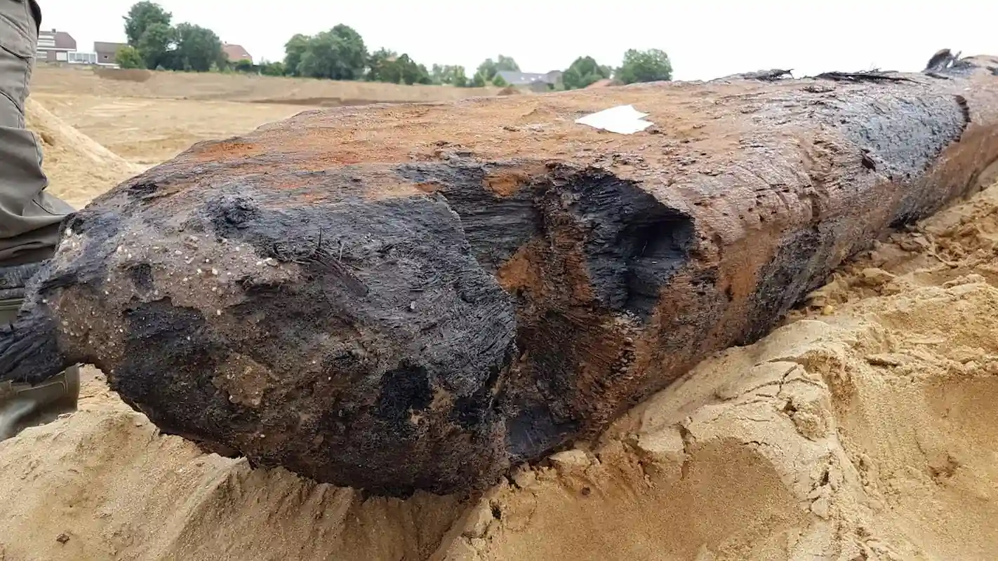
The largest surviving pile measures approximately 11.5 meters (37.7 feet) in length.
Researchers estimate that the original structure exceeded 13 meters (42.6 feet) before centuries of decay removed its upper sections.
The lower ends remained embedded in the riverbed, where oxygen-poor conditions preserved the wood in remarkable condition.
Waterlogged environments often act as natural conservation chambers.
Because microorganisms responsible for decomposition require oxygen, submerged wood can survive for centuries or even millennia.
As a result, the oak piles retained many details of their original construction.
The timbers show unmistakable evidence of human workmanship.
Roman engineers carefully shaped the sides, flattening and squaring them to facilitate assembly.
Tool marks remain visible on portions of the wood.
Researchers also identified signs of insect activity and weathering on some sections, indicating that parts of the piles periodically rose above the waterline.
These observations provided important clues about how the structure functioned.
The bridge was not merely built beside the river.
It was designed to span it.
Dating the Structure
Determining the age of the timbers was a crucial step in understanding their significance.
To investigate further, Gelderland Province commissioned the archaeological firm Vos Archeo, led by archaeologist Wouter Vos.
Researchers employed dendrochronology, the scientific study of tree-ring growth patterns.
Each year, trees add a new growth ring.
By comparing these rings with established chronological sequences, scientists can often determine precisely when a tree was felled.
The results were striking.
The oak trees used for the structure were cut down in A.D. 363.
This date places the construction firmly within the Late Roman Empire, a period characterized by political uncertainty, military conflict, and increasing pressure along Rome’s frontiers.
Far from belonging to an early imperial settlement, the bridge was built during one of the empire’s most challenging centuries.
Its construction demonstrates that Roman authorities continued investing substantial resources in infrastructure despite growing instability.
Bridge, Dock, or Pier?
When archaeologists first encountered the wooden remains, several interpretations were considered.
Could the piles belong to:
- A dock?
- A riverside jetty?
- A mooring platform?
- A bridge?
Careful analysis gradually narrowed the possibilities.
The enormous size of the timbers suggested they supported substantial loads.
Their position in the middle of the ancient river channel also argued against a simple docking facility.
Most compelling were the similarities between the newly discovered remains and known Roman bridge structures excavated elsewhere.
Researchers noted particularly strong parallels with Roman bridge remains found at Cuijk, another site located farther south along the Meuse.
The dimensions, placement, and engineering characteristics closely matched those associated with major river crossings.
Taken together, the evidence strongly supports the conclusion that the piles once formed part of a large bridge spanning the river.
A Strategic Crossing Point
Landscape reconstruction has helped researchers understand why Roman engineers selected this location.
The bridge appears to have connected areas near present-day Moordhuizen in Gelderland and Lith in North Brabant.
During the Roman period, this stretch represented one of the narrowest crossing points in the middle Meuse basin.
Building at such a bottleneck offered significant advantages.
A narrower river required fewer construction materials and reduced the overall span of the bridge.
At the same time, the crossing remained capable of supporting substantial traffic.
For Roman planners, the location was ideal.
The bridge would have connected important transportation corridors while minimizing engineering challenges.
Its placement demonstrates a sophisticated understanding of both geography and logistics.

Infrastructure on the Frontier
The bridge’s strategic importance becomes even clearer when viewed within its historical context.
By the fourth century, northern Europe formed part of the Limes Germanicus, the fortified frontier separating Roman territory from neighboring Germanic groups.
This frontier stretched across hundreds of miles and represented one of the empire’s most important defensive zones.
The nearby city of Nijmegen, known to the Romans as Noviomagus, served as a key military center.
Troops stationed there required reliable transportation routes for communication, reinforcement, and supply.
Yet the region posed significant environmental challenges.
The Meuse and Waal rivers frequently flooded.
Seasonal inundation could render roads impassable for extended periods.
Military units moving through the area often faced delays caused by waterlogged terrain and unstable crossings.
A permanent bridge provided a solution.
Rather than relying on ferries or temporary structures, Roman forces could cross safely even during periods of high water.
The bridge ensured that troops, equipment, and supplies could continue moving regardless of seasonal conditions.
In military terms, it represented a critical piece of infrastructure.
The Year 363: A Critical Moment
The date established through dendrochronology is particularly significant.
A.D. 363 fell during a period of mounting tension throughout the Roman Empire.
Only a few decades earlier, the empire had survived a succession of crises involving civil wars, invasions, and economic instability.
Along the northern frontier, Germanic groups increasingly challenged Roman authority.
Maintaining control required constant military vigilance.
At the time, Emperor Julian, often known as Julian the Apostate, sought to strengthen imperial defenses and restore stability.
Although Julian died in 363 during a campaign against Persia, the infrastructure projects initiated during his reign reflected Rome’s continuing commitment to its frontier provinces.
The newly discovered bridge demonstrates that the empire was still investing heavily in permanent construction projects even as external pressures intensified.
Rather than abandoning peripheral regions, Roman administrators continued reinforcing them.
The Land of Rivers
The region known today as Rivierenland, or the “Land of Rivers,” occupies a unique place in Dutch geography.
Shaped by the Meuse, Waal, and Rhine river systems, it has long served as a natural transportation corridor.
In antiquity, these waterways connected distant settlements and facilitated trade across northwestern Europe.
At the same time, the rivers created obstacles.
Crossings were essential.
Control over bridges often translated directly into economic and military power.
The discovery suggests that Roman authorities recognized the strategic value of Rivierenland and incorporated it more thoroughly into their transportation network than previously believed.
What once appeared to be a peripheral landscape may have played a far more important role in regional logistics.
Roman Engineering at Its Finest
The bridge also highlights the extraordinary engineering capabilities of Roman builders.
Across the empire, Roman engineers constructed:
- Roads
- Aqueducts
- Harbors
- Fortifications
- Bridges
Many of these structures survived for centuries after the fall of Rome.
Building a bridge across a major river required careful planning.
Engineers needed to assess:
- River depth
- Flow speed
- Seasonal flooding
- Foundation stability
- Structural loads
The massive oak piles discovered in the Meuse reflect this expertise.
Their length and placement suggest a structure designed to withstand both strong currents and changing water levels.
The bridge was not a temporary solution.
It was intended to endure.
What the Discovery Means
The discovery does not radically rewrite Roman history.
However, it does refine historians’ understanding of how the empire functioned in its northern territories.
It provides direct evidence that:
- Roman infrastructure extended deeper into the Dutch river region than previously documented.
- Significant resources were invested in transportation networks during the Late Roman period.
- Military mobility remained a priority despite increasing frontier instability.
- The Rivierenland region played an important role within broader imperial logistics.
These findings contribute to a growing body of research showing that Rome’s northern frontier was far more dynamic and interconnected than once assumed.
A Hidden Legacy Beneath the River
For more than sixteen centuries, the remains of the bridge lay hidden beneath layers of river sediment.
Floods came and went.
Empires rose and fell.
The wooden foundations remained preserved in silence beneath the waters of the Meuse.
Today, their rediscovery provides a rare opportunity to glimpse a forgotten chapter of Roman history.
The bridge stands as a testament to the determination of Roman engineers, the strategic importance of the frontier provinces, and the enduring value of archaeology in revealing the past.
As research continues, the Meuse River may yet yield additional clues about the roads, settlements, and structures that once connected the northern edge of one of history’s greatest empires.
What began as a routine sand extraction project has become a reminder that even beneath familiar landscapes, remarkable pieces of history remain waiting to be found.